The main concentration of Nieuw Amsterdam’s settlement was at the southern tip of Manhattan Island, indicated here at the left end of the island by two windmills and the outline of the fort. Dirck’s actual residence in 1639, indicated by a blue dot, was near the intersection of Pearl Street and Wall Street. He commuted across the East River to tend his farm, not moving his family there until 1645. Indian wars in 1643 and 1655 forced Dirck and other Long Island farmers to retreat to the Manhattan fort.
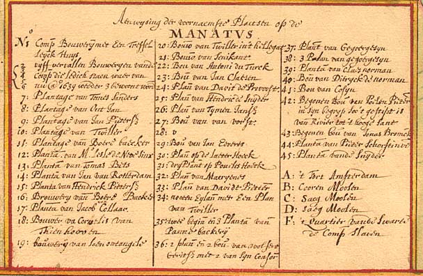
Details on the original map were numbered and listed in the index at bottom right. Dirck Volckertszen’s bouwery on Long Island was entered on the index as “40: Bou van Ditryck de Norman” (underlined), but the map maker then forgot to write the “40” on the map. A red dot, just above the index, now shows where Dirck’s farm house stood. An enlarged copy of the index is found below the map.